

 4Site Survey £1200.00
 Detailed Description
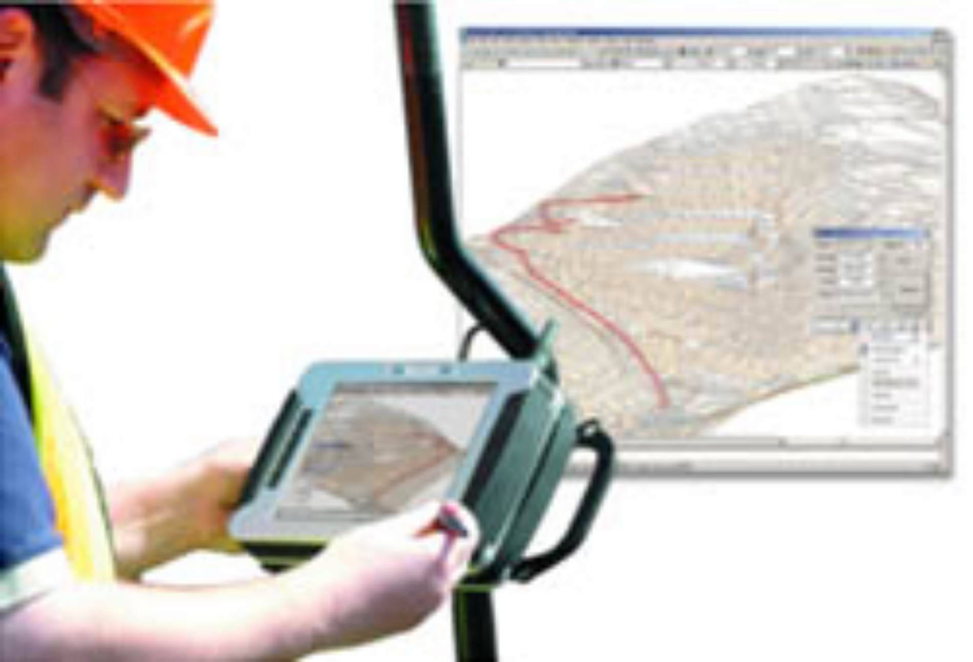
4Site Survey (both for AutoCAD and Stand Alone) requires a portable tablet PC, preferably ruggedised, which connects with your total station or GNNS receiver using cables or blue tooth. Readings are recorded directly into 4Site, creating a survey in front of your eyes. For 4Site Survey working drawings can be taken into the field for setting out or checking as built surveys. Most survey instruments are supported including Leica (robotics), Topcon, Sokkia and early Trimble instruments.
The 4Site AutoCAD plug-in removes much of the tedium when Surveying. 4Site Office allows downloading and processing of data from on-board logging whilst 4Site Survey is for in-field use as a data logger.
4Site has the same feel as AiC's popular n4ce software using a Project approach with data being accessed off a Project Tree. Simple editing is permissable in the spreadsheet like grids. Where appropriate large icons are used for ease of use with tablet PC's being used for data capture.
At the heart of 4Site is a Code Table. This converts your instrument readings into a CAD drawing. 4Site Office is ideal for those of you who wish to produce a survey drawing quickly from field data recorded and stored on-board instruments. Reduction, traverse and resection calculations convert your raw survey data into co-ordinates. Import filters are available for external co-ordinate inputs from GPS receivers.
As soon as an angle/distance measurement is taken, or a GPS reading recorded, the software automatically converts the data into the local XYZ co-ordinate system of the drawing. It is simply a matter of deciding what to do with the information you record. Your existing survey equipment effectively becomes an advanced digitizer/mouse.
Features & Benefits
- Downloading and processing of data from on-board logging whilst 4Site Survey is for in-field use as a data logger.
- Simple editing in spreadsheet-like grids.
- Code Table converts your instrument readings into a CAD drawing.
- Reduction, traverse and resection calculations convert your raw survey data into co-ordinates.
- Import filters are available for external co-ordinate inputs from GPS receivers.